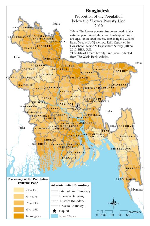
The population under the poverty line was mapped using data from 2010, illustrating the geographic distribution of poverty across different regions in Bangladesh. This map highlights areas with higher concentrations of individuals living below the poverty line, providing a visual representation of socioeconomic disparities.