Menu
Home
Research
Publications
Projects
Contact
Useful Links
Notebook
News
Kazi Jihadur Rashid
Home
Research
Publications
Projects
Contact
Useful Links
Notebook
News
Search
Menu
Kazi Jihadur Rashid
Portfolio
Remote Sensing Analysis
Prepared land cover data by classifying Landsat imagery using the Random Forest classifier in the QGIS software to understand the forest cover loss in Rohingya refugee camps after the influx of 2017 (Rashid et al., 2021).
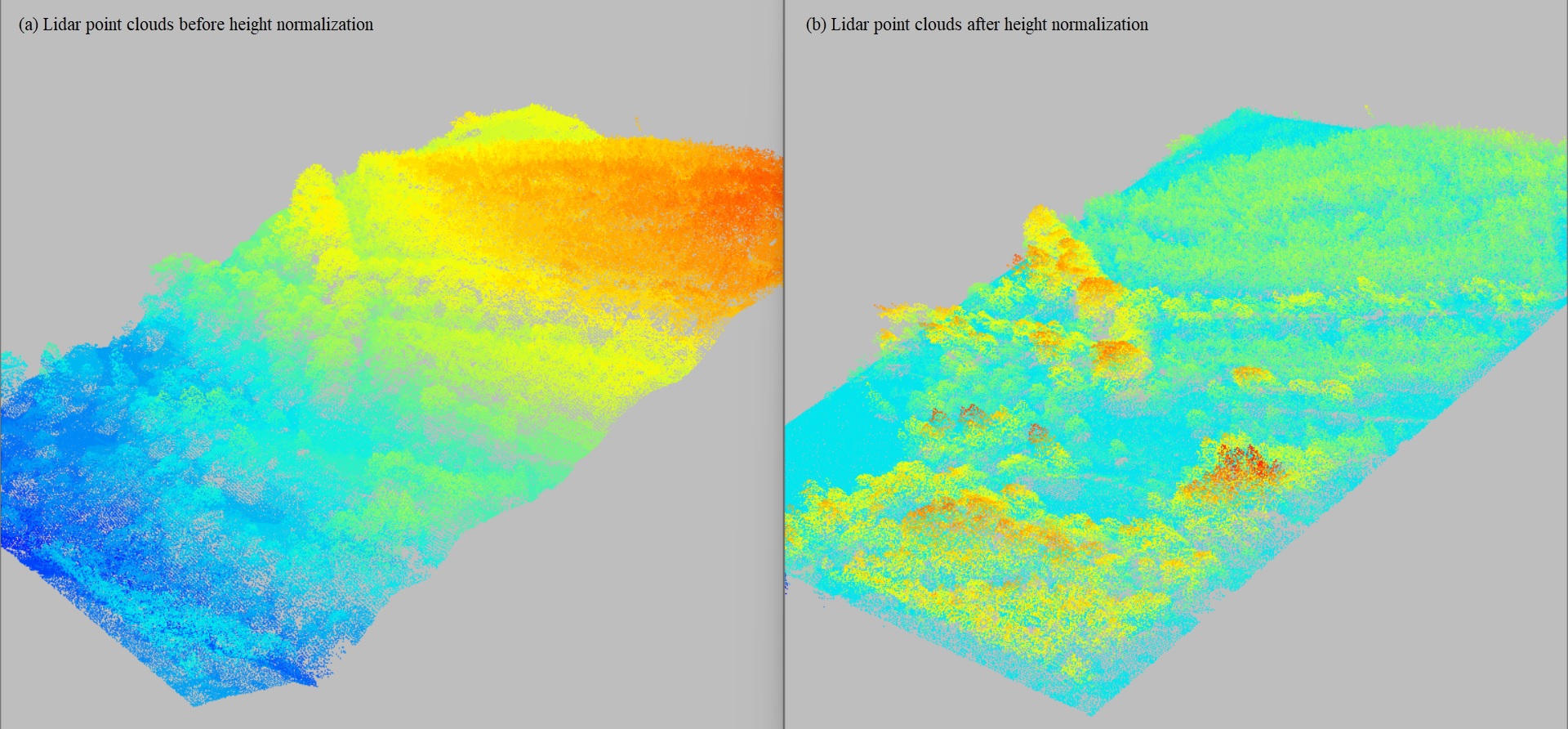
While practicing Lidar data processing, I explored ground classification using the cloth simulation filter (CSF) to separate terrain from non-terrain points, aiding in the creation of accurate DEMs. I then used the triangulated irregular network (TIN) method for height normalization, ensuring the point cloud accurately represents the ground surface for further geospatial analysis.
Extracted land surface temperature (LST) from Landsat data (TIRS sensor) employing the Plank Equation to understand the impact of massive deforestation in Rohingya refugee camps after the influx of 2017 (Rashid et al., 2021).
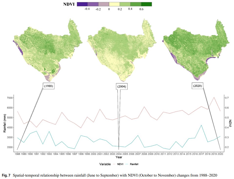
The spatial-temporal relationship between rainfall (June to September) and NDVI (October to November) changes from 1988 to 2020 reveals how variations in monsoon rainfall influence vegetation growth. The analysis demonstrates that higher rainfall during the monsoon season correlates with increased NDVI in the following months, highlighting the delayed but impactful response of vegetation to precipitation patterns across different regions during the study period (Akter et al., 2023).
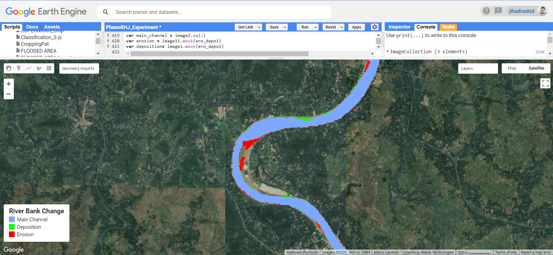
Extraction of rivers from Landsat images in the GEE platform. This task was aimed to measure erosion from medium-sized rivers of Bangladesh.
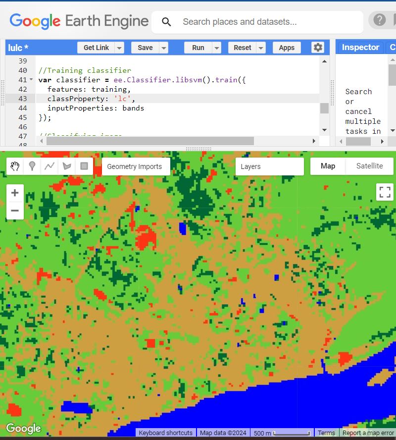
Preparing land use and land cover data from classifying Landsat imagery using the Support Vector Machine in the GEE platform.
© 2024
All Rights Reserved by
Kazi Jihadur Rashid
.
Close
Search
Home
Research
Publications
Projects
Contact
Useful Links
Notebook
News
Search
Start typing to see posts you are looking for.